Contributers: Audrey Smith, Carly Muir, Erin Bunting, Elizabeth Mack...
Background :
- Large-scale land acquisitions (LSLA), also termed land grabs, are the sale or lease of land and water resources by less developed countries to mostly transnational agri-industrial companies for commercialized agriculture.
- Africa contains the highest rate of contractd land (> 22 million ha) because of cheap land and labor costs, and the high potential to reduce yield gaps with modern agricultural practices and irrigation systems.
- Many of these deals use the land for the production of commodity and food crops that require large amounts of water, such as cotton, rice, and sugar cane. Further jeopardizing water supplies, and in countries like Ethiopia or Sudan, worsens the effects of already endemic water scarcity (Freitas, 2013).
- Crops are typically exported back to the investor countries or sold in regional or international markets. Meanwhile, a large proportion of the food consumed in African countries is either imported or produced by smallholder farmers who rely on often limited land and water resources
- Despite the notion that LSLA will improve food security there has been little evidence showing this to be true, while mounting evidence suggests a strong link between conflict and LSLA. It has been proposed that land grabs will become another important cause of water shortages in the coming decades.
Research Questions: We base this analysis on the premise that LSLAs are often associated with water-grabs, as the shift to intensive commercial agriculture at transaction sites often require use of the water resources on which local populations depend. The competition for resources can lead to conflict at various scales and land/water grabs (LWG) are believed to exacerbate existing tensions, particularly when they occur in areas with current resource scarcity. This project investigates the co-occurrence of LWG and conflict in Africa. We ask the following research questions:
-
Where are the hotspots of LSLAs and conflict events across the African continent?
-
Do LSLA and conflict hotspots co-occur (spatially & temporally)- i.e., do we find significant hotspots of both conflict and LSLAs at
a) the continental scale,
b) the regional scale,
c) within watershed/basin boundaries, and
d) in areas with greater water insecurity/scarcity?
Main Datasets:
- Conflict events: ACLED; UPSALA
- Land/water grabs (LSLAs): Global Land Matrix
- African continent watersheds/basins: Transboundary Water Assessment Programme (TWAP)
Large-Scale Land Acquisitions
The LM dataset contains individual points of known LSLAs > 200ha in size. The dataset is largely unbalanced, but potentially useful attributes of the geospatial dataset include:
- Location of land aquired (at regional level)
- Size of land acquisition (in hectares)
- Year of signature of contract (concluded deals, ranging 2000-2018)
- Nationality of acquirer of land
- Water extraction (Yes/No)
- Water source (Groundwater/Surface)
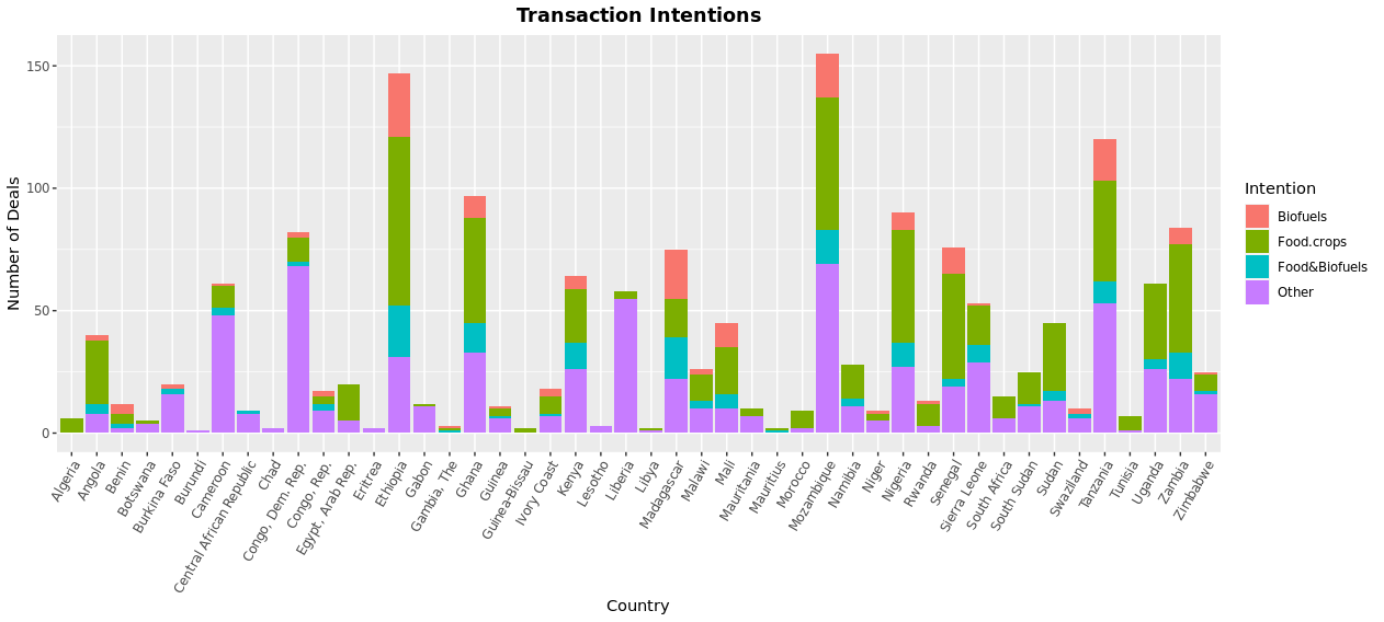
- Intention of land deal (Biofuel, Food crops, Both biofuel and food crops, Other)
- Presence of land conflict (Yes/No)
- Previous land cover/land use
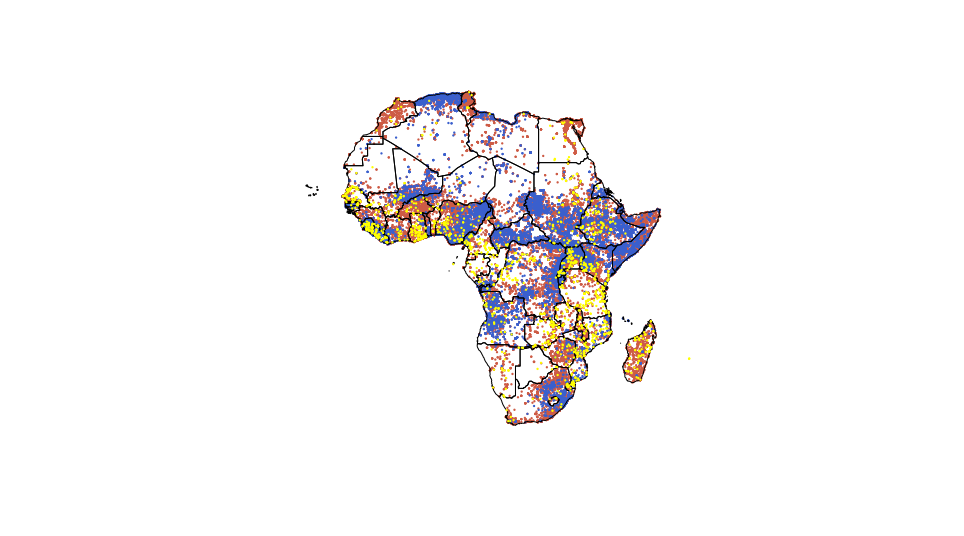
ACLED & UPSALA Conflict Events and Mapped LM LSLA Locations
Legend: Yellow-LSLAs; Brown-ACLED; Blue-UPSALA
Summary Statistics:
LSLA Data
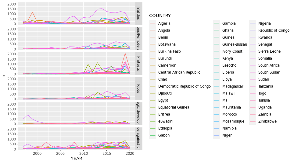
Conflict Data
Preliminary Results & Progress:
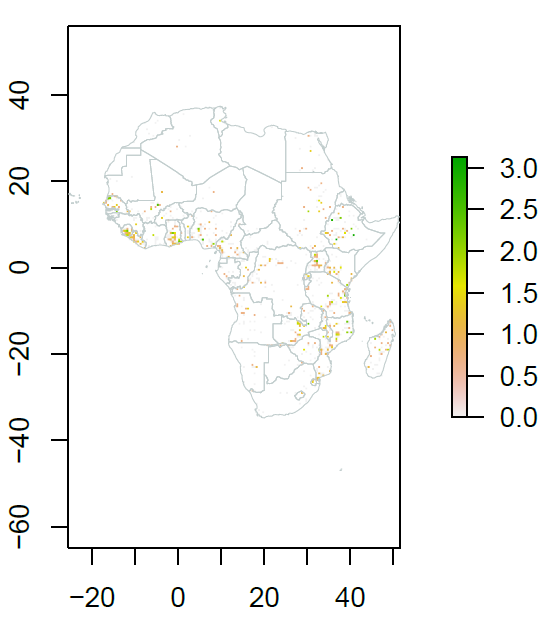
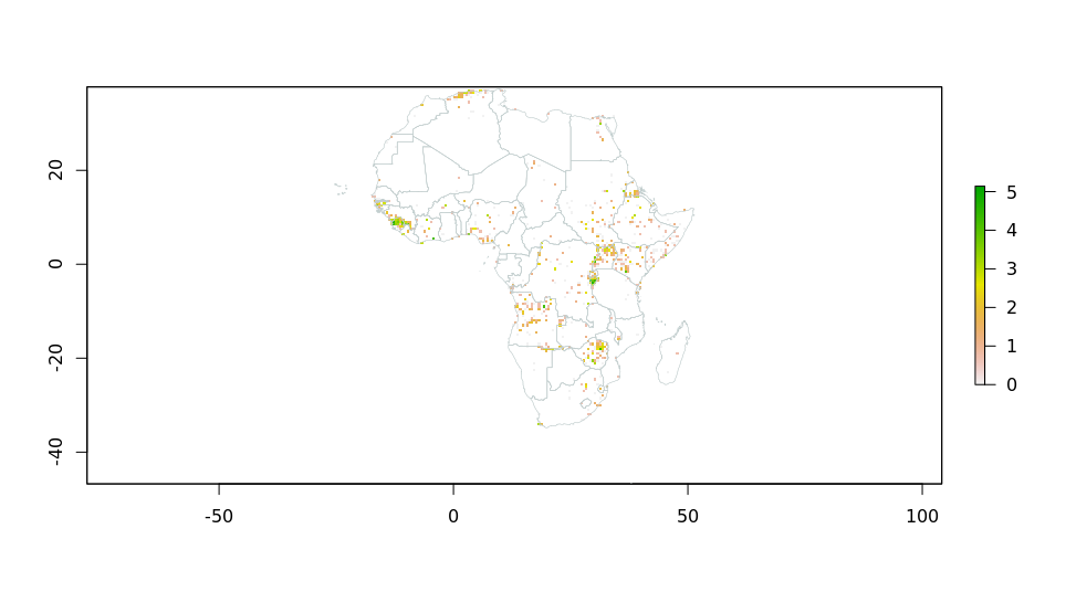
LSLAs Hotspot Map
Conflict Hotspot Map
Current Objectives/Future Work:
- Develop framework based on human security
- Create conceptual model/diagram based on human security framework
- Refine research questions & hypotheses
- Aggregate LSLA & conflict data by watershed/basins
- Incorporate other datasets
- Implement colocation quotient


