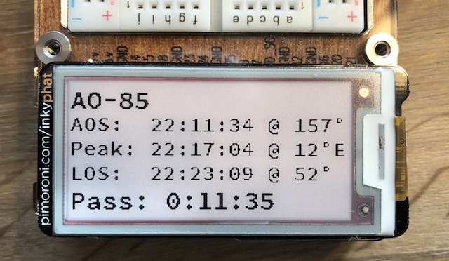
First attempt at writing a tiny satellite pass program to fetch telemetry data via a public API and pass formatted text to a Pimoroni Inky PHAT on a Raspberry Pi
After cloning the github repository, move to the directory in a terminal and run: pipenv install
If you don't have pipenv installed, from your terminal run: pip install pipenv
Activate the virtual environment by pipenv shell and run python3 inky_amsat.py
Don't forget to change your Latitude, Longitude, and Altitude to match your location
Make your selections from the menu prompts for either an FM satellite, transponder satellite, or to manually type in the 5-digit NORAD ID of the satellite that you want to pull telemetry data for (i.e. 25545 for the ISS)
- Ben Cook on Twitter
- Without a Raspberry Pi and a Pimoroni InkyPHAT, this won't run
- Built for Python3
- At the request of the API owner, I have utilized caching for the web calls. Please don't modify that to something less than a minute.
- Option to attempt to automatically pull gps data for location if one is available on the system
- Possibly a second program to evaluate a list of satellites and tell you the best choice based off pass length or max elevation
- Possibly an option to track a specific satellite and continue to update the eInk display for a set amount of time like 24-hours
